Get the right information, with visual impact, to the people who need it
Avoid domain errors by using Taylor series

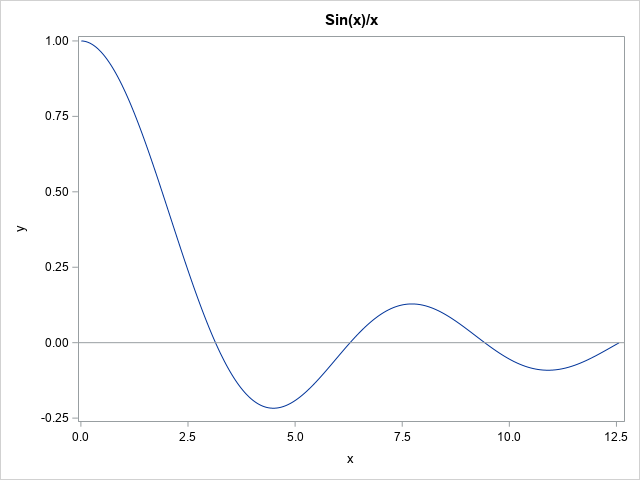
The other day I was trying to numerically integrate the function f(x) = sin(x)/x on the domain [0,∞). The graph of this function is shown to the right. In SAS, you can use the QUAD subroutine in SAS IML software to perform numerical integration. Some numerical integrators have difficulty computing