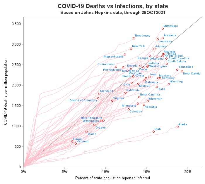
A scatter plot is my go-to graph! It's what I often start with to get a feel for the data ... and I often end up using just a scatter plot. But some scatter plots are better than others ... In this blog post, I create a scatter plot of
Canada is a geographically large country, but I've heard that much of the population lives in the small southernmost sections (near the US border). I decided to use my mapping skills, and put that to the test. Follow along, and we'll see what that looks like on a map ...
With the 2020 Census numbers starting to come out, it's interesting to look at what states are gaining (or losing) people. In this example, I create a custom map similar to the ones the US Census Bureau likes to use, and plot the 10-year change in population. But before we