Everybody likes to learn a bit of interesting trivia... It could make you look smart, or might help you win a bet in a bar. Or maybe give you something to amaze your kids with. Do you know what's the biggest non-domesticated land animal in your state? How about all 50 states? Would a special map help? Hmm - sounds like a job for the Graph Guy!
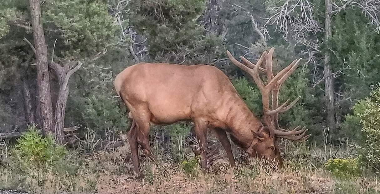
But first, I asked my Facebook friends to send me their picture of the biggest animal they had seen in their travels. My friend Eva sent this picture she took of an elk, in Arizona. That thing's pretty big -- but is it the biggest animal in the state? Let's find out!
The Original Map
I first came across this topic in the reddit 'dataisbeautiful' group. The title piqued my curiosity, and at first glance their map looked pretty clean and straightforward.
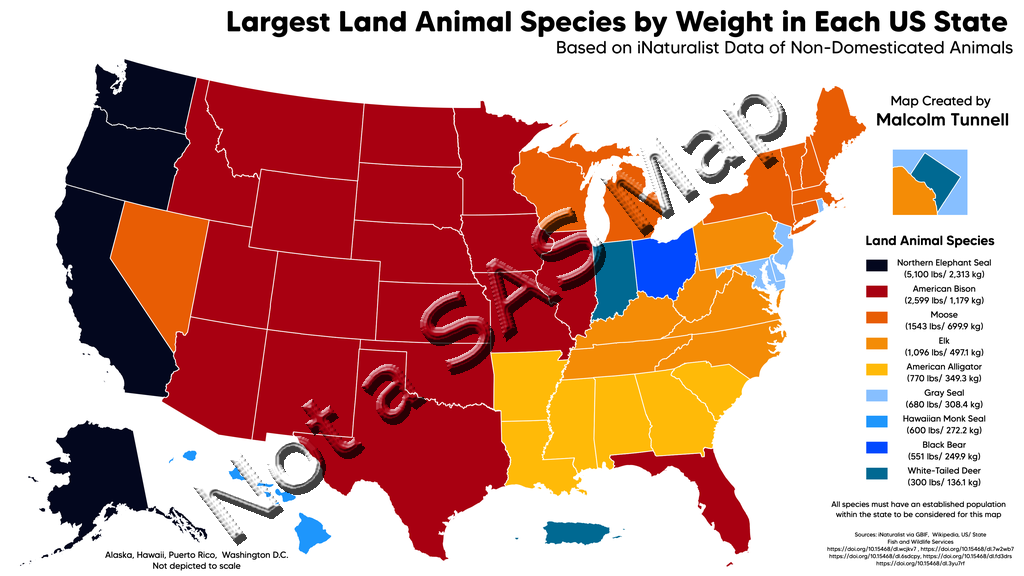
But the true test of a map is whether or not it conveys the information easily. Arizona (the state where Eva took the picture of the elk) was red, therefore I looked up the red color-chip in the legend and found that the largest animal in that state is actually a bison (buffalo). So far, the map seems useful!
While I was looking at the legend, I went down to the next color - orange/moose, and then tried to find the orange states in the map. Well, there are several shades of orange, therefore I had to concentrate pretty hard to make sure I found the correct/matching orange. Similarly there were 3 shades of blue. And the more I looked between the map and the legend ... the less I liked looking between the map and the legend.
I also noticed the title claimed it was a map of "US States" ... but yet Puerto Rico and Washington DC were included (and it took me a while to figure out that the square graphic above the legend was Washington DC, by the way). There also seemed to be too much information in the legend, with both the animal names and their weight. And the legend text was centered, therefore some of the text was far away from the color-chip.
I try not to complain about a map, without volunteering to create a better version. So I set about creating my own new/improved version.
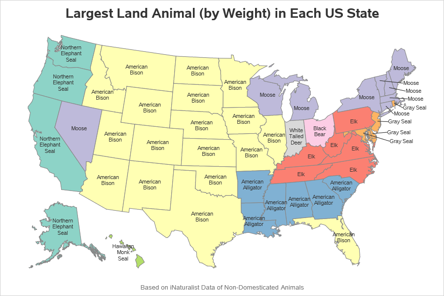
My Version of the Map
Rather than using a color legend, I placed the names of the animals directly on the states. Some of the names were a bit long, therefore I used the sgmap text splitchar= option to split the text onto another line at each space, or dash.
text x=land_x_text y=land_y_text text=animal / position=center splitchar=' -';
Also, rather than using bright/bold colors, I used more subdued shades of color - this is less harsh on the eyes, and helps the text names show up better. I left out Puerto Rico and Washington DC (since they're not states), and I show the state names, animal names, and weight in in mouse-over text in the interactive version (rather than trying to show all that text/information on the map).
Were you surprised by any of the information in the map? Feel free to discuss in the comments. There are also some interesting details in the original reddit thread if you're interested in the data.
Here's a link to the interactive version of my map (with mouse-over text), and a link to the full SAS code if you'd like to see all the details.


8 Comments
I did not expect that moose lived in Nevada.
See what you can learn from a good map! 🙂 https://www.gohunt.com/read/news/moose-in-nevada
Nevada has a "moose over".
Mike, Mike, Mike ... (shaking my head) LOL
King of North America’s mammals, the American bison is a magnificent bovine, or wild cow, which is widely called the “buffalo,” although true buffalo belong to a different genus restricted to the Old World.
So far as I know, SAS has many customers outside the USA. How about showing us the rest of the world sometimes? Maps of much larger areas are more challenging. I'd like to see how SAS deals with these, please. For example, can you do better than this: https://www.gapminder.org/tools/#$chart-type=map ?
I do sometimes! 🙂
Pingback: How to (mis)label a map - Graphically Speaking