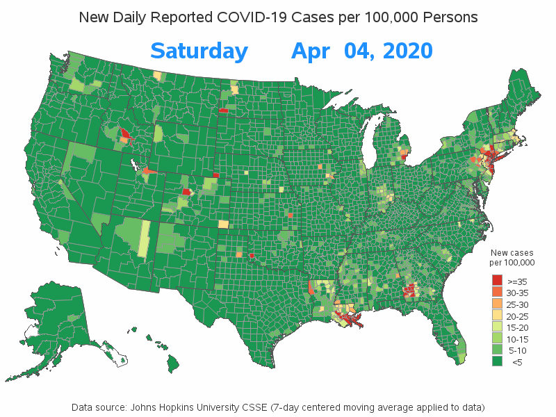
Animating US COVID-19 data over time, on a county map

Now that we are many months into the COVID-19 pandemic, we can start to reexamine the data and look for trends. This time, I want to explore how COVID-19 has been spreading around the US. I do this by animating a county map over time. What is animation? Are you