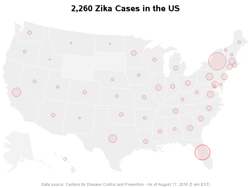
As Zika starts spreading into the US, it will be important to have a way to track it. Therefore I wrote some SAS code to pull the latest data from the CDC website, and plot it on a map... But before we get into the details of my map, I

As Zika starts spreading into the US, it will be important to have a way to track it. Therefore I wrote some SAS code to pull the latest data from the CDC website, and plot it on a map... But before we get into the details of my map, I
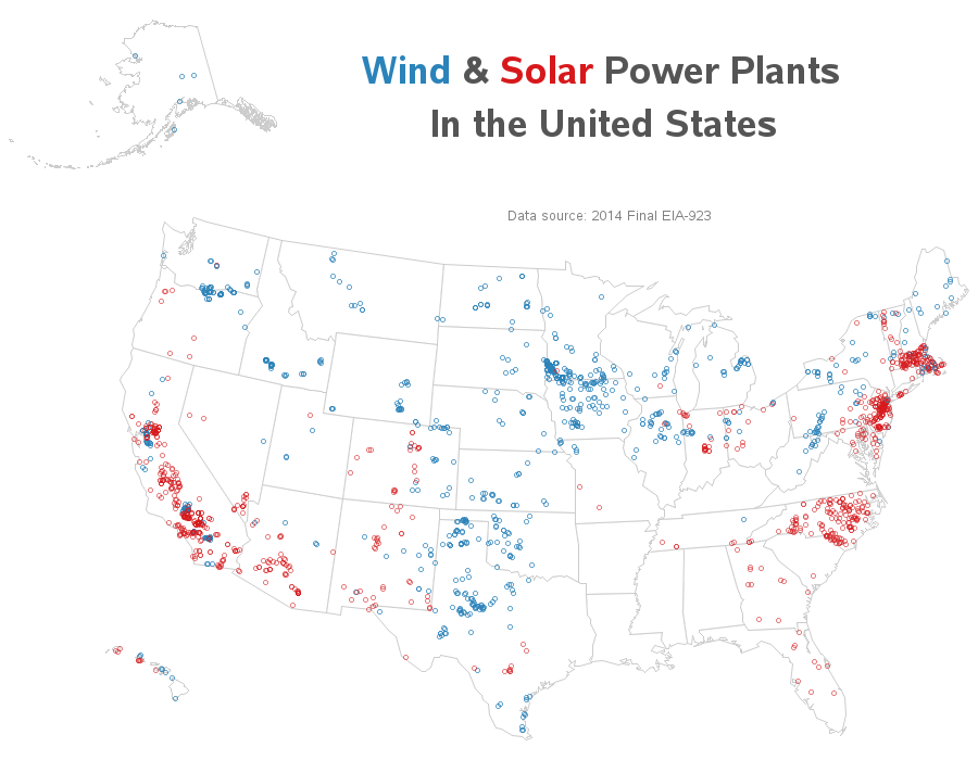
Where is solar and wind power generated in the US? Let's visualize this data on a map... I recently saw the following map on the metricmaps.org website. It caught my attention because it looks like North Carolina has a lot of solar power plants, whereas our neighboring states have very few.
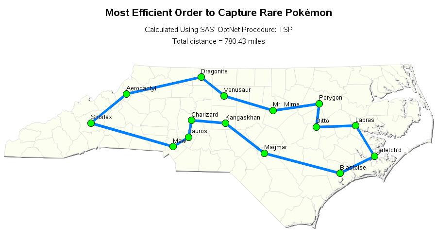
Were you the kid who sat there analyzing the amusement park map before entering the park, planning out how you could visit the most rides in the least amount of time? If so, then this blog's for you, my data analyst kindred spirit! And to get you in the mood,
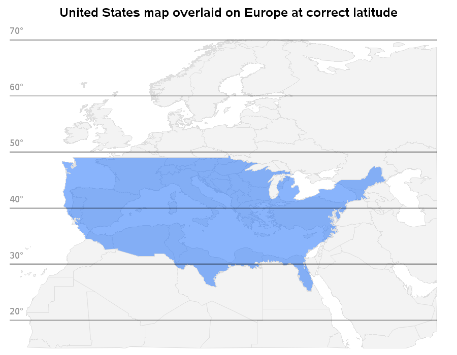
What would it be like if the US was in the EU? I don't know how that would work out politically, but this map shows how it might look geographically (if the US was literally picked up and moved to Europe!) My buddy Rick Langston is a bit of a
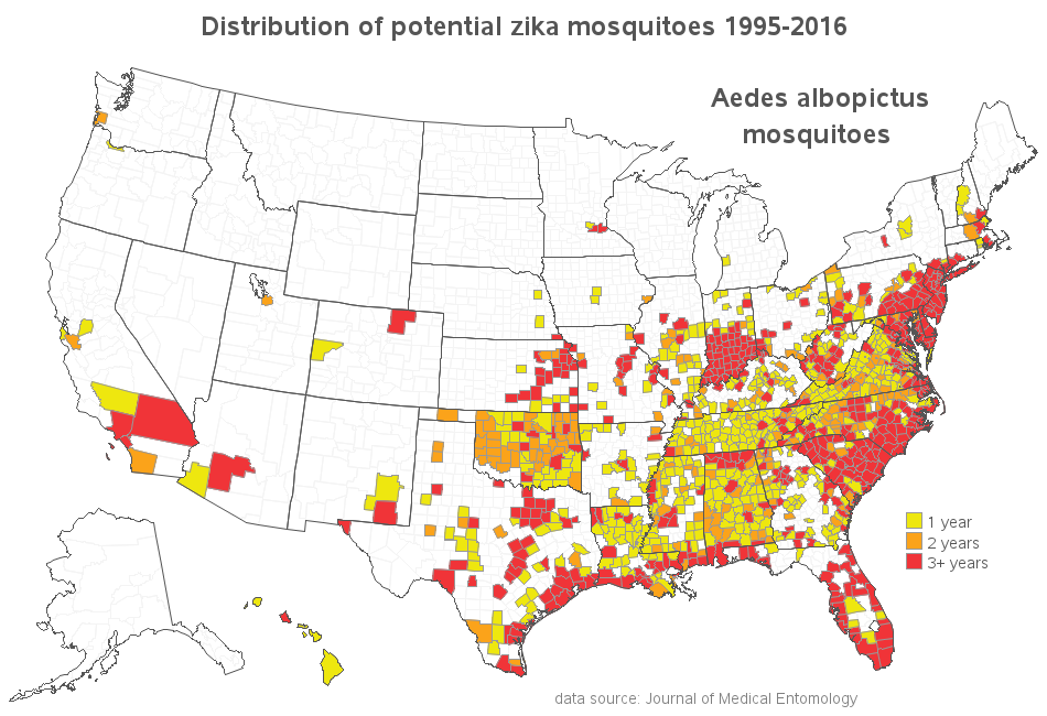
Let's create a souped-up SAS map that can track Zika-carrying mosquitoes down to the county level, in the US! A few months ago, I wrote a blog post with a world map of documented locations of the Aedes mosquitoes that could carry the Zika virus. The world map showed a high concentration

Do you need help picking a summer vacation destination - one that's not just great, but surreal? If so, this blog's for you! It's that time of the year again - I've got gobs of vacation time saved up, but I was drawing a blank on where to go... So I turned
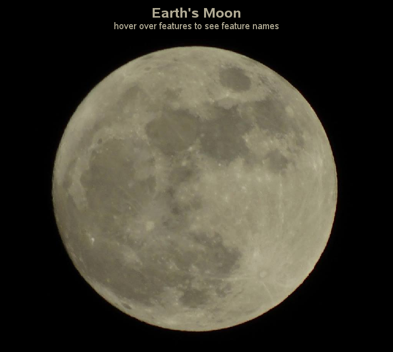
When I was a kid, I remember being fascinated by the first moon landing. I probably won't ever get to explore the moon in person, but perhaps creating an interactive moon map is the next best thing! Before we get started, I wanted to share a couple of photos my co-worker
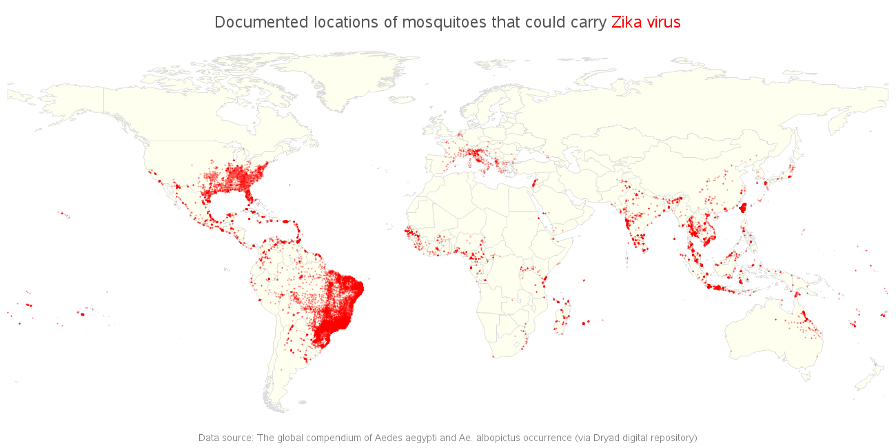
The World Health Organization recently declared the Zika virus a global public health emergency. This virus is spread by certain mosquitoes, and therefore if we know where those mosquitoes are located, then we've got a pretty good idea of where the virus might spread. Before we get to the numbers, here
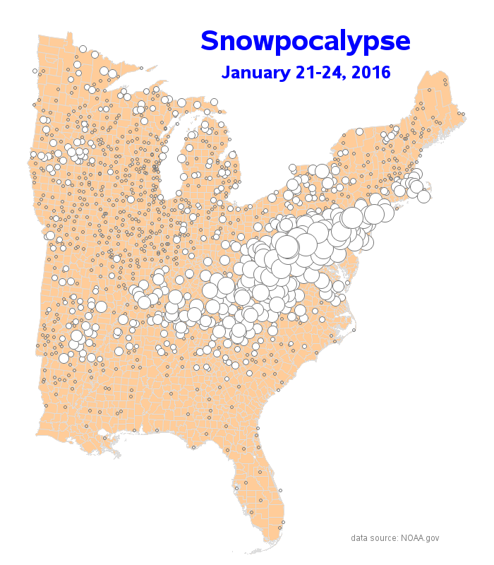
The East Coast of the US got quite a snowstorm this past weekend, but did your area get enough snow to brag about? Let's see what the data says... Before we get started, here are a couple pictures of the snow. The first one is from my driveway - we didn't
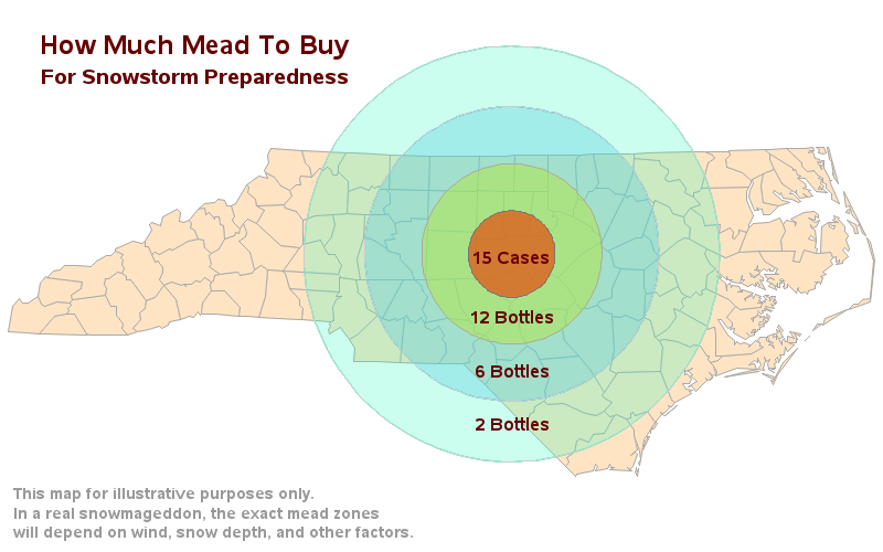
The East Coast is having lots of snow and ice storms today, and SAS headquarters is officially closed. But I thought it would be a great day to get a few things done! And among those few things is "write a snow-related blog". Hope you enjoy it! After 21 years of