Robert Allison gives you tips about mapping tools to help take yours to the next level.
Your mapping toolkit tip #6 - Geocoding your addresses

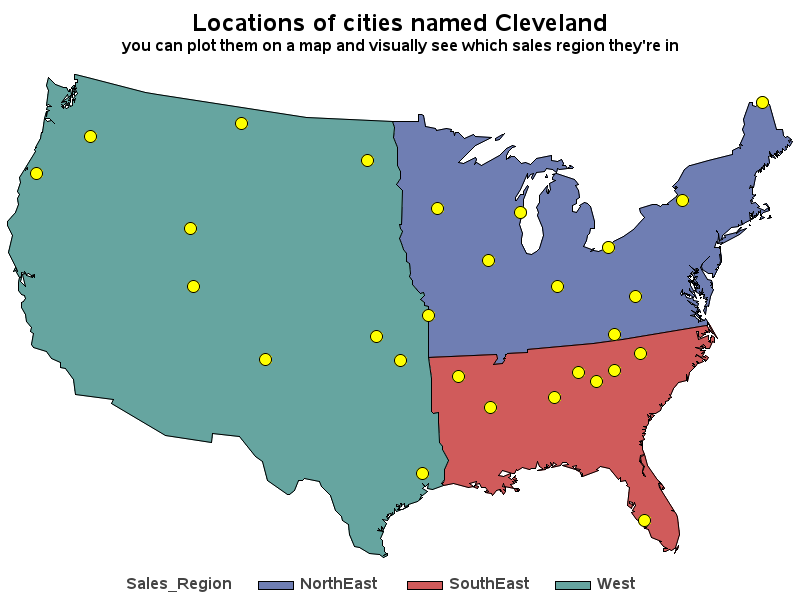
You've got a database containing the addresses of all your customers ... but how can you plot them on a map or analyze them spatially? First, you'll need to convert the address into a numeric coordinate (latitude & longitude). SAS can do that ... with Proc Geocode! But before we