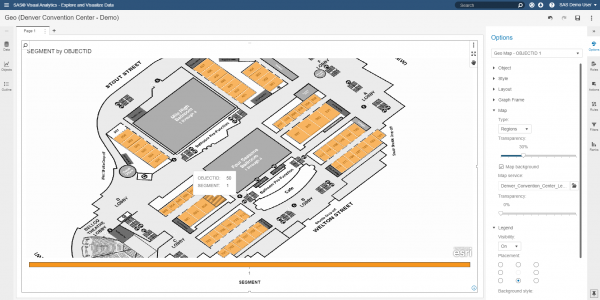
Building and visualizing custom polygons in SAS Visual Analytics
Can you use a data visualization tool to display building maps, floor designs and other Esri data? With the recent addition of custom polygon support in SAS Visual Analytics 8.2, customers wondered if this feature can be utilized to render different types of regional overlays. A common request is to


