Get the right information, with visual impact, to the people who need it
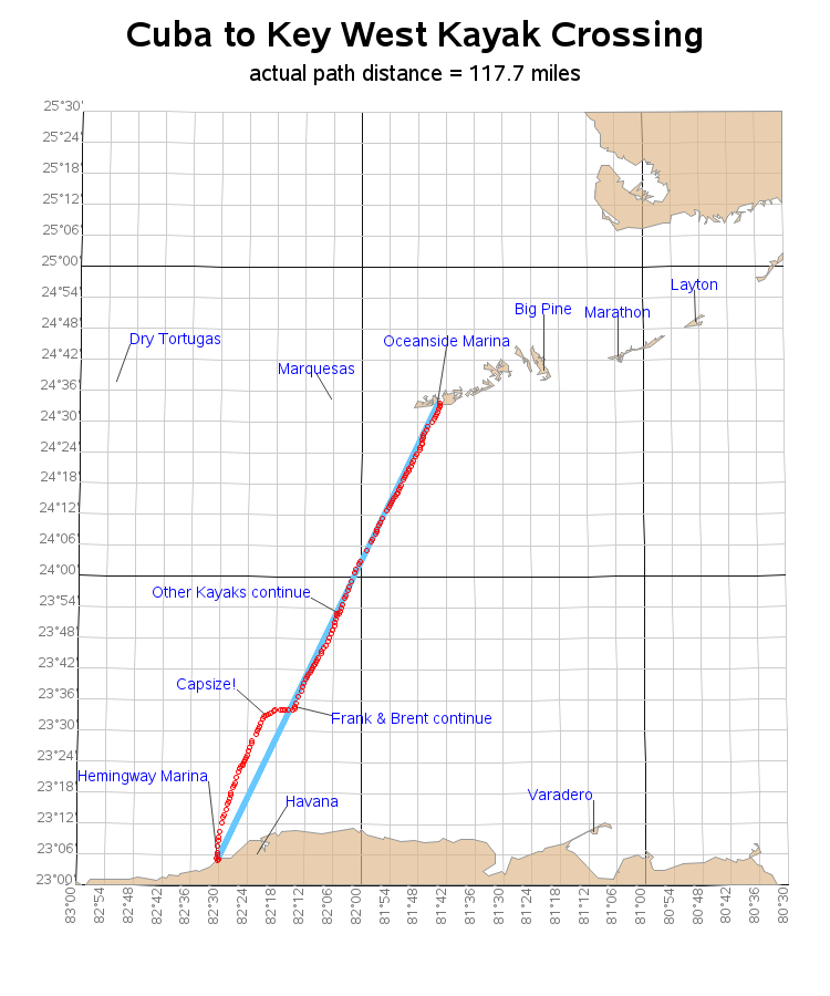
These days many devices (such as smart phone apps, Fitbits, Apple watches, dog tracking collars, car gps, hiking gps, teen/car trackers, etc) can track your location, and provide you with standard/canned ways to analyze the data. This blog post shows how I created a custom SAS map of the tracking

