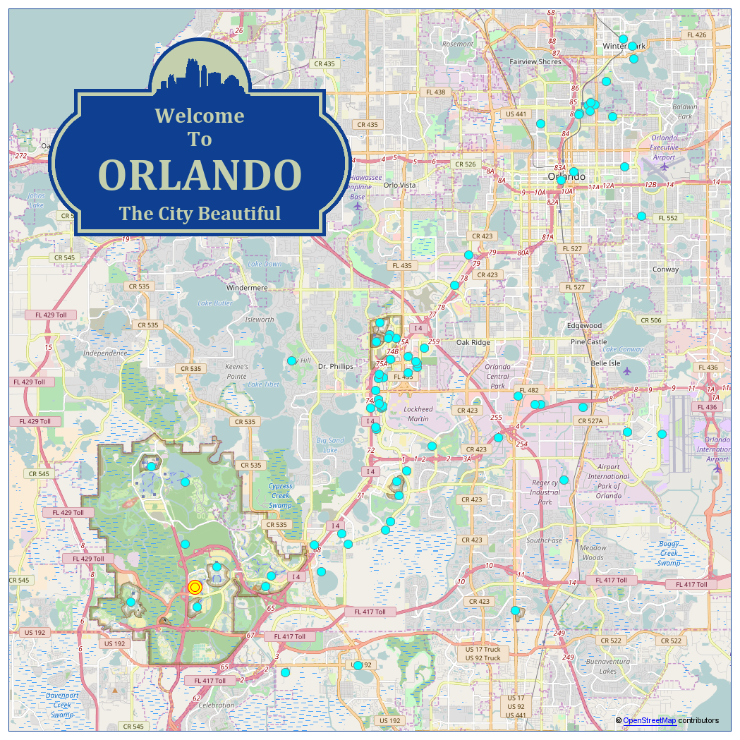
They say "a picture is worth 1000 words" - and I think it might be more like 2000 when it comes to planning out fun/interesting things to do in a new city! I'm going to the SAS Global Forum (#SASGF) conference in Orlando this year, and I was wondering where the conference hotel was in relation to the fun things to do in the area. So, of course I plotted it all out on a map, using SAS! You might enjoy seeing how I created the map, and you might find the map itself useful if you ever visit Orlando.
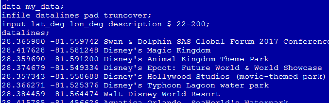
First, I compiled a list of things to do in Orlando (using web searches & asking my friends for recommendations). I estimated a latitude/longitude value for each thing, and read them into a SAS dataset using code like this ...
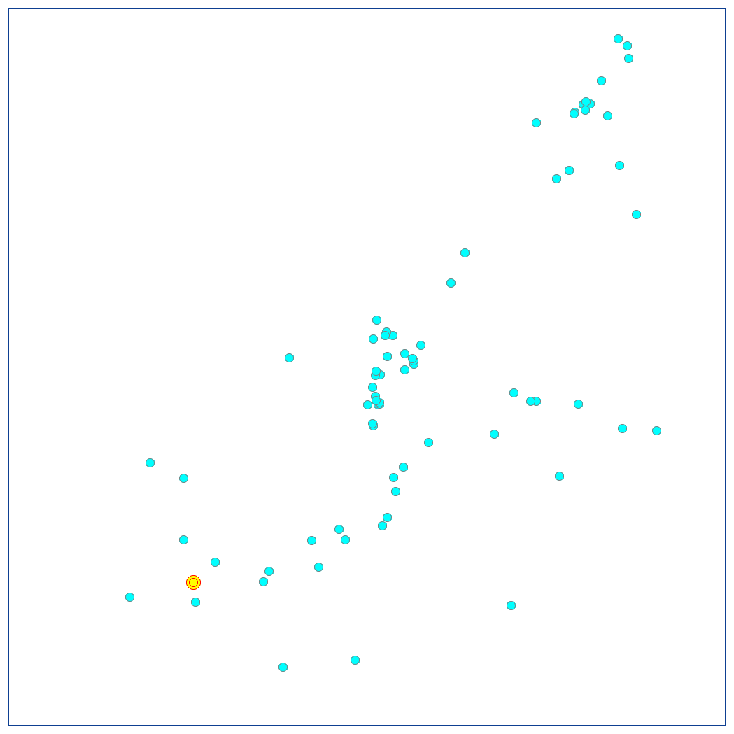
I then created a scatter plot of the locations, and suppressed all the axes (note that the yellow marker is the main conference hotel) ...
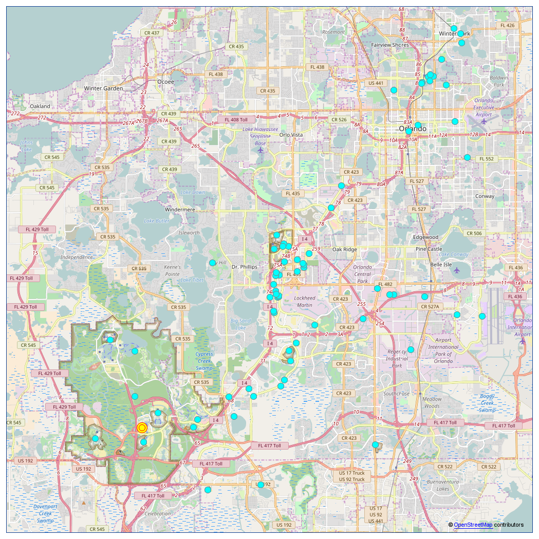
Next, I wrote SAS code to download the 16 slippy map tiles (16 separate png images) at zoom level 12 for the area of interest, and I annotated the 16 tiles behind the scatter plot.
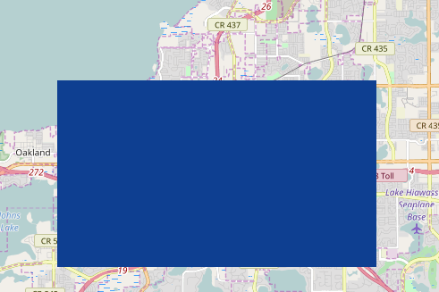
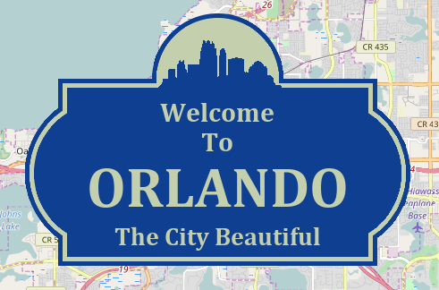
And now for the cool part ... In my maps, I often like to add a little graphic element to let people quickly/easily know what the map represents. In my Las Vegas map, I created my own version of the famous 'Welcome to Las Vegas' sign. The 'Welcome to Orlando' sign isn't quite as fancy, but I thought it would be a nice touch to add to this map. I could have found an image of the sign, and annotated the image ... but where's the fun in that?!? So I decided to create my own version of the sign using simple annotated graphical shapes and text.
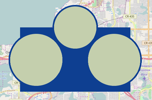
First, I created a blue box.
Then I added some blue bubbles with slightly smaller lighter-colored bubbles inside them.
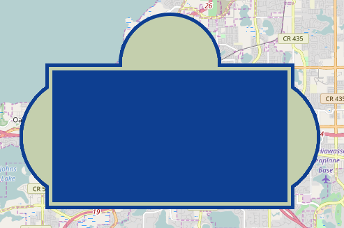
Then, I overlaid a box using the light color, followed by a slightly smaller blue box.
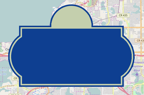
Then a couple more blue bubbles, so fill-in some on the left and right sides.
Adding some text almost finished the sign! ... But it still needed a little something to set it off!
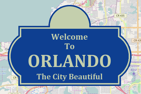
And that special something is the skyline. I got a skyline image, and modified it in Photoshop Elements, making the background transparent and the buildings the same color as my sign. I then used annotate to add the image seamlessly in the desired location. Wow - did you know SAS could do all that!?!
I think the welcome sign really helps spice up an otherwise boring street map! Click the map image below to see the interactive version, where the markers have mouse-over text (and they drill down to a Google search on each attraction).
What are your favorite things to do in Orlando? Did I leave out anything?!? Feel free to leave a comment ...


6 Comments
"And now the cool part ..." should be the title of your blog. This is terrific!
One might want to see the 'real' Florida by visiting one of our beautiful state parks. Wekiwa Springs State Park is a bit north of Orlando and is very beautiful. https://www.floridastateparks.org/park/Wekiwa-Springs
As one who grew up in Orlando (before WDW), I'm delighted to see that you include some of the earlier attractions. Lake Eola in downtown Orlando and the boat tour in nearby Winter Park are well worth a tourist's time. Thanks for sharing the map!
Great to see you have kept up the #SASGF tourist map tradition. Very helpful!!!
I heard that there is a Legoland in Winter Haven, Florida - 45mins from Orlando. Is it possible to include it in your very useful interactive map? :-) https://www.legoland.com/florida/
Details coming soon, but conference attendees will have to go no farther than breakfast or lunch (in the Dolphin Pavilion) to have some fun with Lego!
Sounds great! - Can't wait!