Let's create a souped-up SAS map that can track Zika-carrying mosquitoes down to the county level, in the US!
A few months ago, I wrote a blog post with a world map of documented locations of the Aedes mosquitoes that could carry the Zika virus. The world map showed a high concentration of Aedes mosquitoes in Brazil, where there is a huge Zika outbreak (and where some Olympic athletes are now refusing to go), but the map also showed a somewhat large number of these mosquitoes in the US. And although the US hasn't had an outbreak of Zika yet, it would be interesting to know specifically which counties might be affected should that happen.
And this brings us to the Centers for Disease Control (CDC) US county map. My blog editor gave me a heads-up about an article on today.com that showed this county map. She mentioned that my SAS maps had spoiled her, because she wanted to be able to hover her mouse over the areas in this map, to see the county names (for example, the 4 yellow counties in NC).
So I set about finding the data, and creating my own SAS map ... with hover-text ... and maybe a few other enhancements, such as a title and a color legend. Yeah, that's it - that's the ticket!
After a bit of Googling, I found a paper about the study in the Journal of Medical Entomology, and thankfully the paper had a link to the data! I copy-n-pasted the data from the Microsoft Word document into a text file, and then wrote SAS code to read the data into a SAS dataset. I used Proc SQL to merge in the numeric FIPS codes for the counties, and then was able to easily plot it on a map. Click on the image/snapshot below, to see the interactive version with mouse-over text to show the county names.
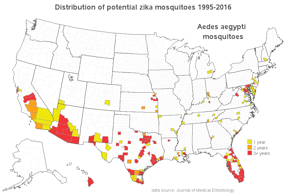
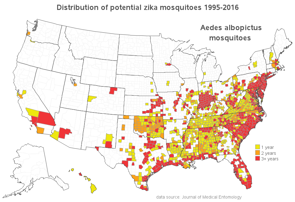
While reading the paper, I noticed that they actually had two maps - one for each of the two mosquitoes that could carry the Zika virus. I don't know why the today.com article only showed one map (and why they chose the map that showed the most sparsely-populated mosquito). Here's my SAS version of the second map, showing the Aedes albopictus mosquitoes. Ironically, I don't really need mouse-over text for this map ... pretty much every county in North Carolina has these mosquitoes - yikes!
So, what's your favorite trick for keeping away mosquitoes? Feel free to share in a comment.Are there #Zika mosquitoes in your county? Click To Tweet
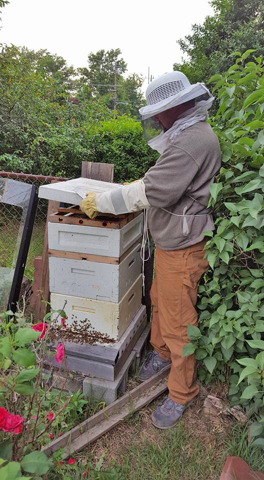
I suppose if we have a really bad Zika outbreak in the US, we could all start wearing beekeeper clothes, eh?!? If it comes to that, my friend Brian is ready! :)


6 Comments
Got a say, your right on time. The news media would be proud! Almost to the day, last year (June 9) you posted about the West Nile virus, I would have guessed West Nile was earlier than last year. I think I like the information/data in the Chicago map with the little red dot better. I'm guessing last year you had better data. This data seems to suggest we've had Zika in the US since 1995. I know it states "potential" mosquitoes. But I would be concerned it would carry the wrong message to an audience. Ah, the power of graphs. I would suggest a graph on how many species of mosquitoes we have in the US? With a sidebar on the Aedes mosquitoes known to carry Zika. Is Zika only in the Aedes and other mosquitoes cannot carry Zika,hmmmm.
As for a mosquito story; When I was much younger I went fishing on a boat with others. Everyone on the boat was being attacked by mosquitoes exempt me. The only reason we could come up with is I was wearing a pair of borrowed loud multi colored pants (think the 70's).
Keep 'em Coming.
Thanks for the observations & suggestions! (and glad to see you remember my West Nile map!) :)
Summer in Australia, particularly outside the cities, there tends to be a shift change at dusk from flies to mozzies (mosquitoes). Not sure of trick to keep them away, a combined sunscreen insect repellent tends to be popular though such as http://www.bushman-repellent.com
Ahh - combined sunscreen & insect repellent ... I guess that gives twice (or more) motivation to put it on! :)
Ahhh... so much better! Now I can get all the information I need right in the graph. Thank you SAS Graph Guy. What would we do without you?? -Maggie, blog editor/graph snob
:)