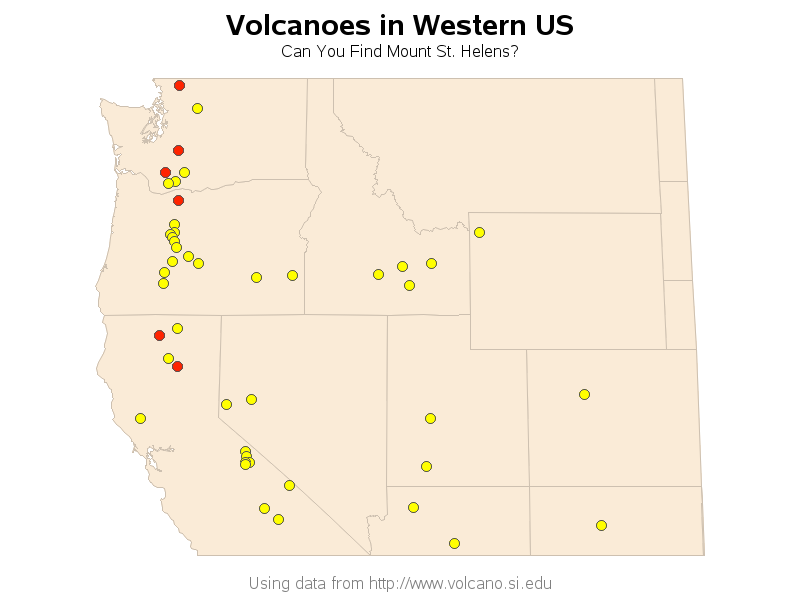
Mount St. Helens volcano here in the US had a big eruption 35 years ago this week! Do you know exactly where it is located? Perhaps this SAS map can help...
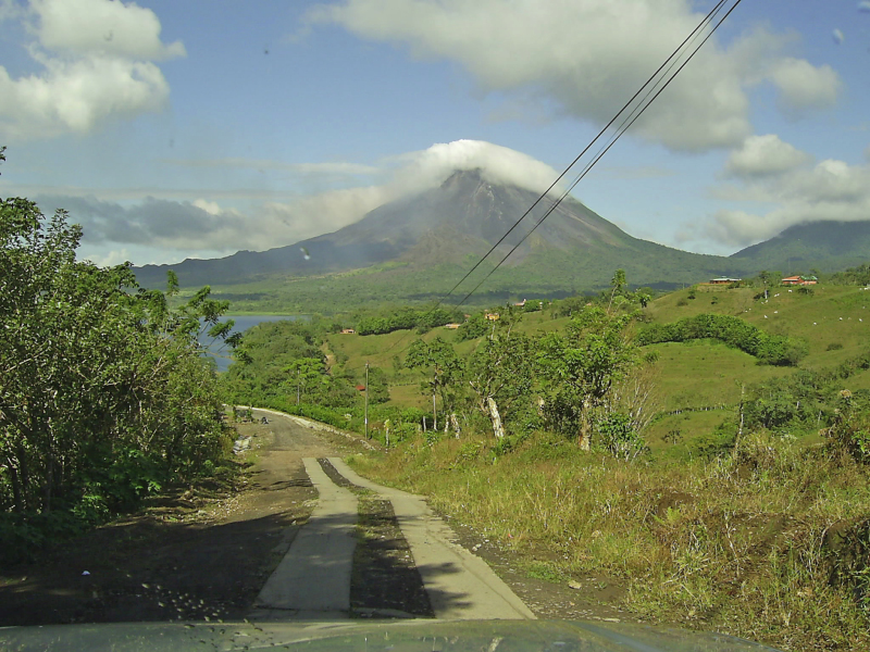
As you might have guessed, I'm a big fan of the awesome power of nature (hurricanes, tornadoes, lightning, earthquakes, and ... volcanoes). I've never been to Mount St. Helens, but I did get to climb a somewhat active volcano named Arenal when I tagged along to Costa Rica with my friend Jennifer. Here's a picture:
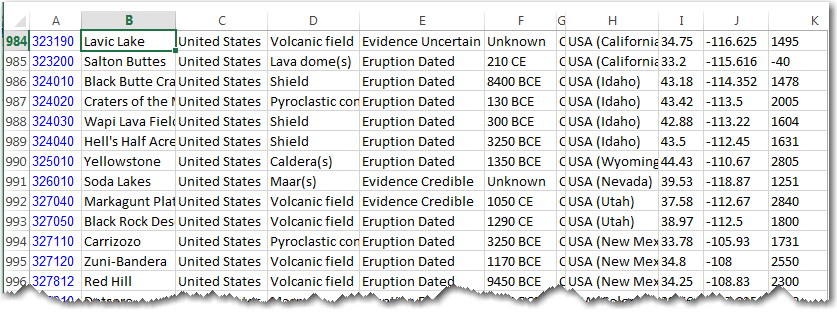
And now, back to Mount St. Helens, and the SAS map that will help you find it! I downloaded volcano data for the entire world from http://www.volcano.si.edu, and then imported the Excel spreadsheet into a SAS dataset.
I then plotted the data as annotated markers on a map, and used Proc Gproject to clip out just the region of interest (in this case, the western US). If you click the map image below, it will take you to the interactive map, and you can see hover-text for each volcano marker (or click on them to drill-down and see the Google satellite image). I've colored the volcanoes that were 'recently' active red - therefore you should be able to find Mount St. Helens in no time!
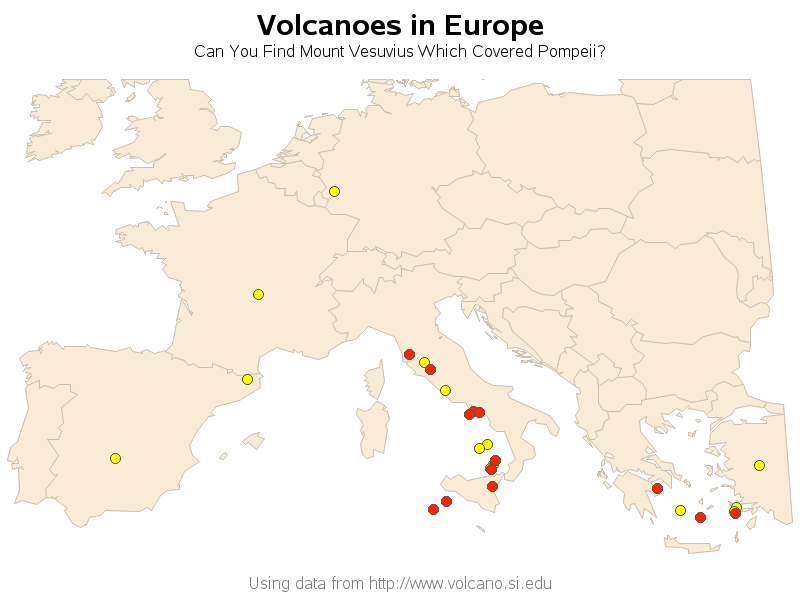
And what about the most famous volcano in the world? In my opinion, that's probably Mount Vesuvius, which covered the city of Pompeii with ash and pumice in 79 A.D. See if you can find that one on this map:
Have you ever experienced a volcano eruption? Feel free to share your story in a comment!

9 Comments
You seem to have forgotten to include Iceland on your map of Europe. A bit of a miss given that the country has had 3 volcanic eruptions in the last 5 years. Eyjafjallajokull, anyone?
I had a great tour of Mount St. Helens a few years back when I extended my trip to the Pacific NorthWest SAS users group meeting. Having no rental car, it took a lot of effort, but it was definitely worth it. You could see the devastation from miles away, even though some of the trees were beginning to come back. But when you got to the official observatory and could look out at the side of the mountain just blow away - it was pretty incredible.
Thanks for the map and for showing how SAS can teach us all so much about so many things!
That's pretty neat!
Love that they make souvenir ashtrays from flowing lava on the side of Mt. Etna:
https://www.youtube.com/watch?v=vIbSPcUjhJk
That's pretty wild!
I was reading in Mental Floss that at any given time, there are about 80 volcanoes erupting around the world...with 3/4 of them being under water.
How can you tell when a volcano is extinct, or simply dormant? Well, it takes a while. If it hasn't erupted in 10,000 years and has been cut off from its magma supply, it's extinct.
Interesting stuff!
I declare you an honorary Vulcan! :)
I shall never forget SAS Global Forum 2010 in Seattle - a colleague and I flew out of Seattle on the final day of the conference which happened to be the day the Iceland Volcano errupted http://en.wikipedia.org/wiki/2010_eruptions_of_Eyjafjallaj%C3%B6kull unfortunately ours wasn't a direct flight to the UK; we were landing in the Netherlands and getting a connecting flight. Of course the connecting flight was cancelled and we spent the next few days travelling around the Low Countries before we eventually got on a ferry from Belgium to Hull in Northern England. It wasn't quite "Planes, Trains and Automobiles" but it got close at times!
Ahh - I always wondered how many "SAS Travelers" were affected by that!