In SAS Visual Analytics 8.1, report creators have the ability to include drive-distance and drive-time in their geographical maps, but only if their site has an Esri ArcGIS Online account and they have valid credentials for the account.
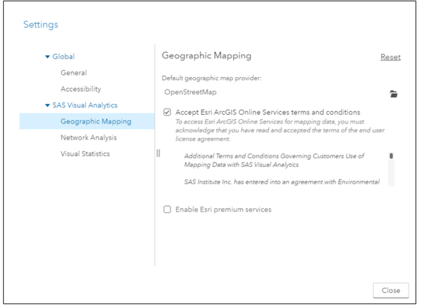
In the user Settings for SAS Visual Analytics Geographic Mapping 8.1 release, there are three choices for selection of a geographic map provider. The map provider creates the background map for geo maps and for network diagrams that display a map.
The map provider options are:
- OpenStreet Map service, hosted at SAS.
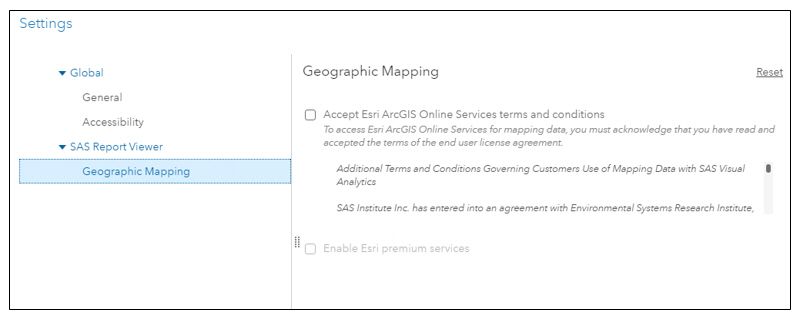
- Esri ArcGIS Online Services, which only requires final acceptance of the terms and conditions.
- Esri premium services, which requires a credential validation.
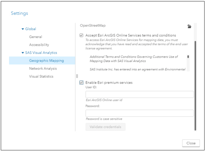
If Esri premium services is selected, there is an additional prompt for valid credentials, and you must still accept the Esri ArcGIS Online Services terms in order to select the premium services checkbox.
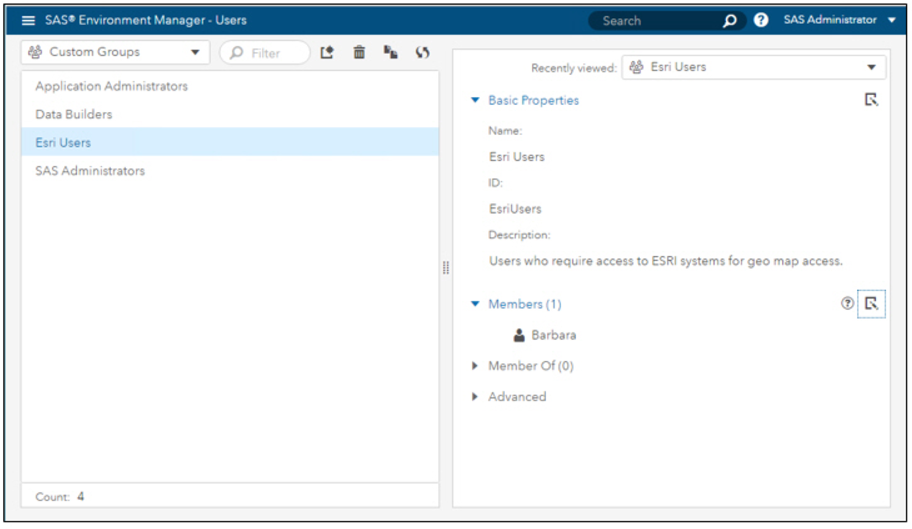
It’s also worth pointing out here, that even if you have Esri premium credentials, in order for these credentials to be validated in SAS Visual Analytics, you must also be a member of the ESRI Users custom group. Users can be added to this group in SAS Environment Manager, as shown below.
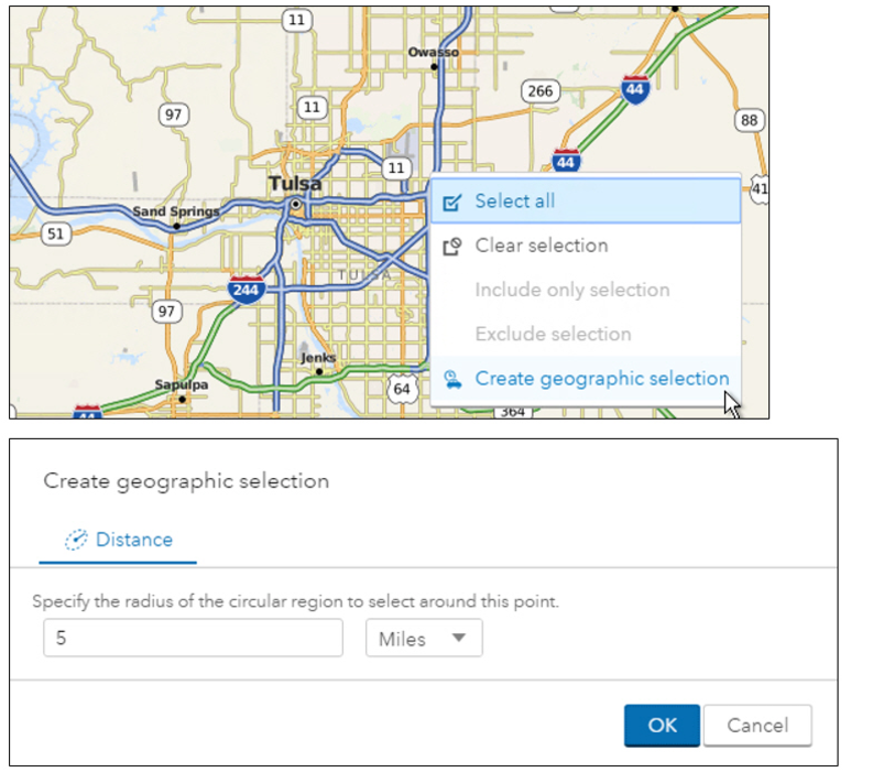
Note that without the Esri ‘premium’ service and validated credentials, when you right-click and Create geographic selection in your report map, you are only able to select the Distance selection, which displays the radial distance for the selection point.
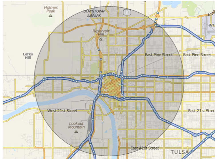
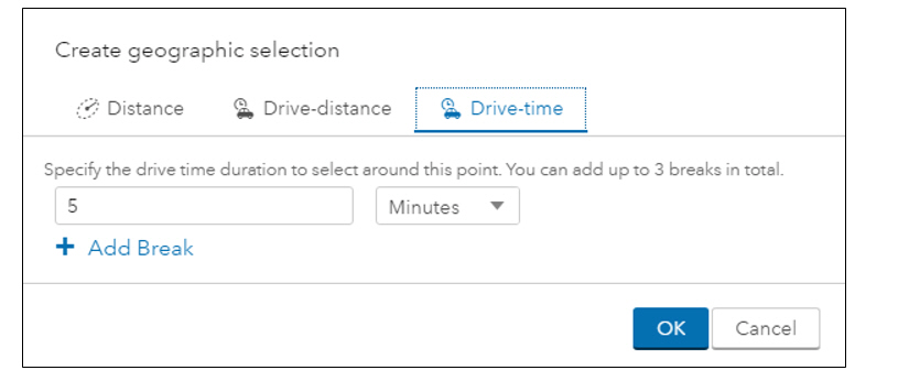
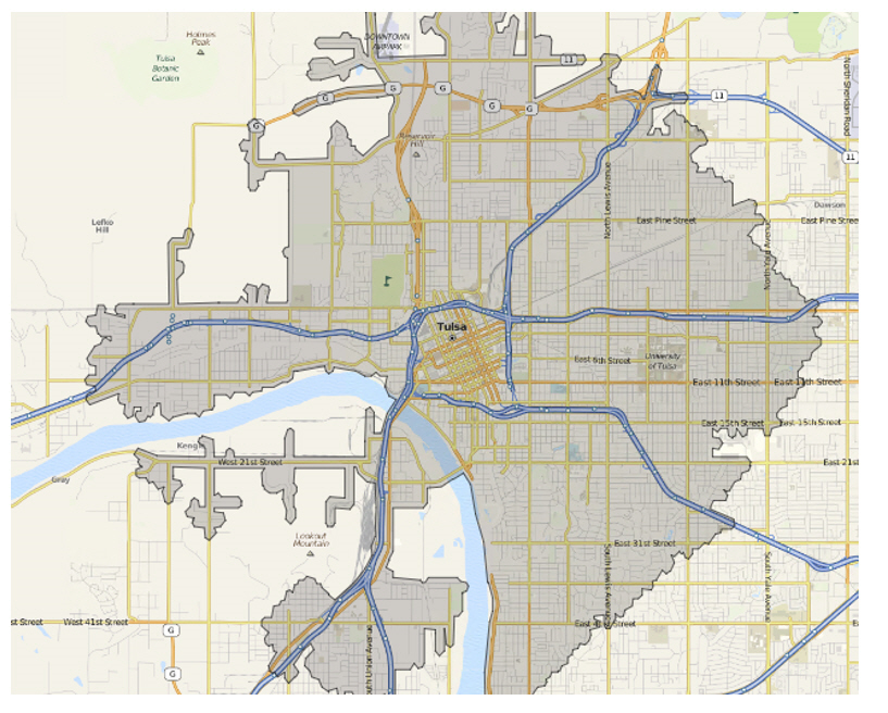
With premium services in effect, you can also select drive-time or drive-distance. An example of a drive-time selection is shown here. Drive-time creates an irregular selection based on the distance that can be driven in the specified amount of time.
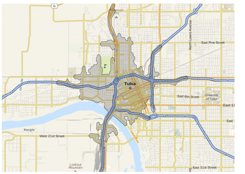
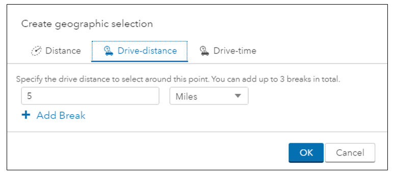
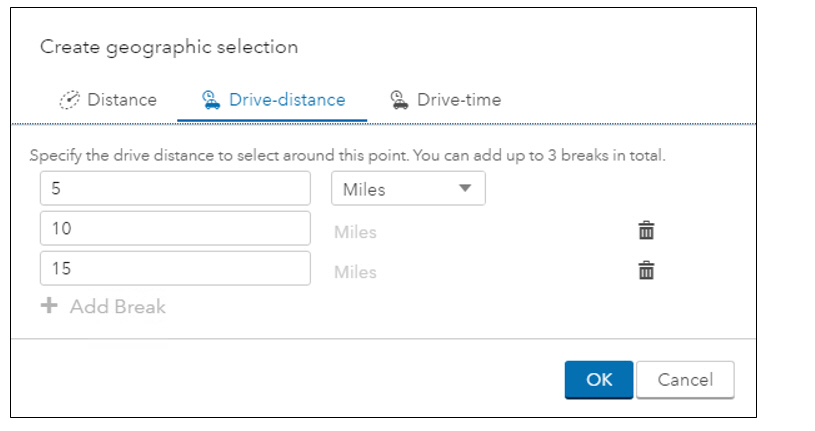
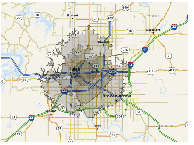
A drive-distance example is shown below. Drive-distance creates an irregular selection based on the driving distance using roads.
When selecting drive-time or drive distance, you can also add breaks to show, as in the example below, the 5-mile distance, the 10-mile distance, and the 15-mile distance on the maps.
It’s also worth pointing out, that if a viewer of the report has not had Esri premium credentials validated, the viewer will be unable to view the drive-distances and drive-time features. The settings for users of the report viewer are also stored in the Report Viewer Geographic Mapping user settings.
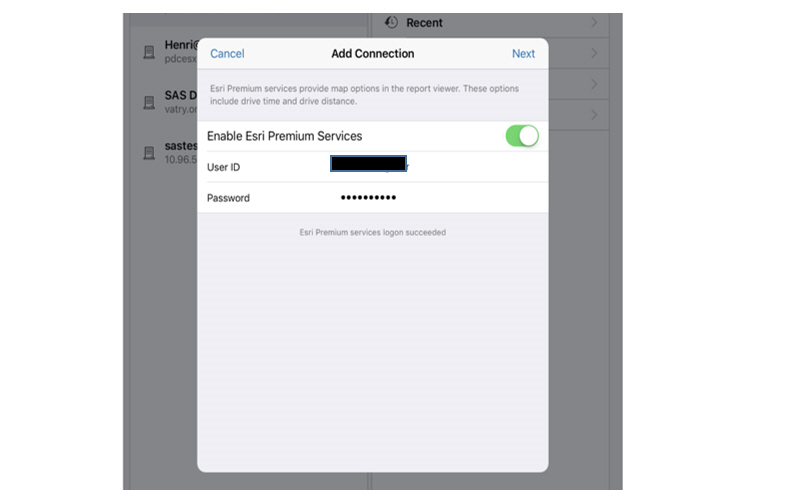
If a user is adding a connection to the server in SAS Mobile BI 8.15 and their account is a member of the Esri Users group, they will be prompted for their Esri premium credentials when adding the server connection:
I hope you’ve found this post helpful.