When I was a kid, I remember being fascinated by the first moon landing. I probably won't ever get to explore the moon in person, but perhaps creating an interactive moon map is the next best thing!
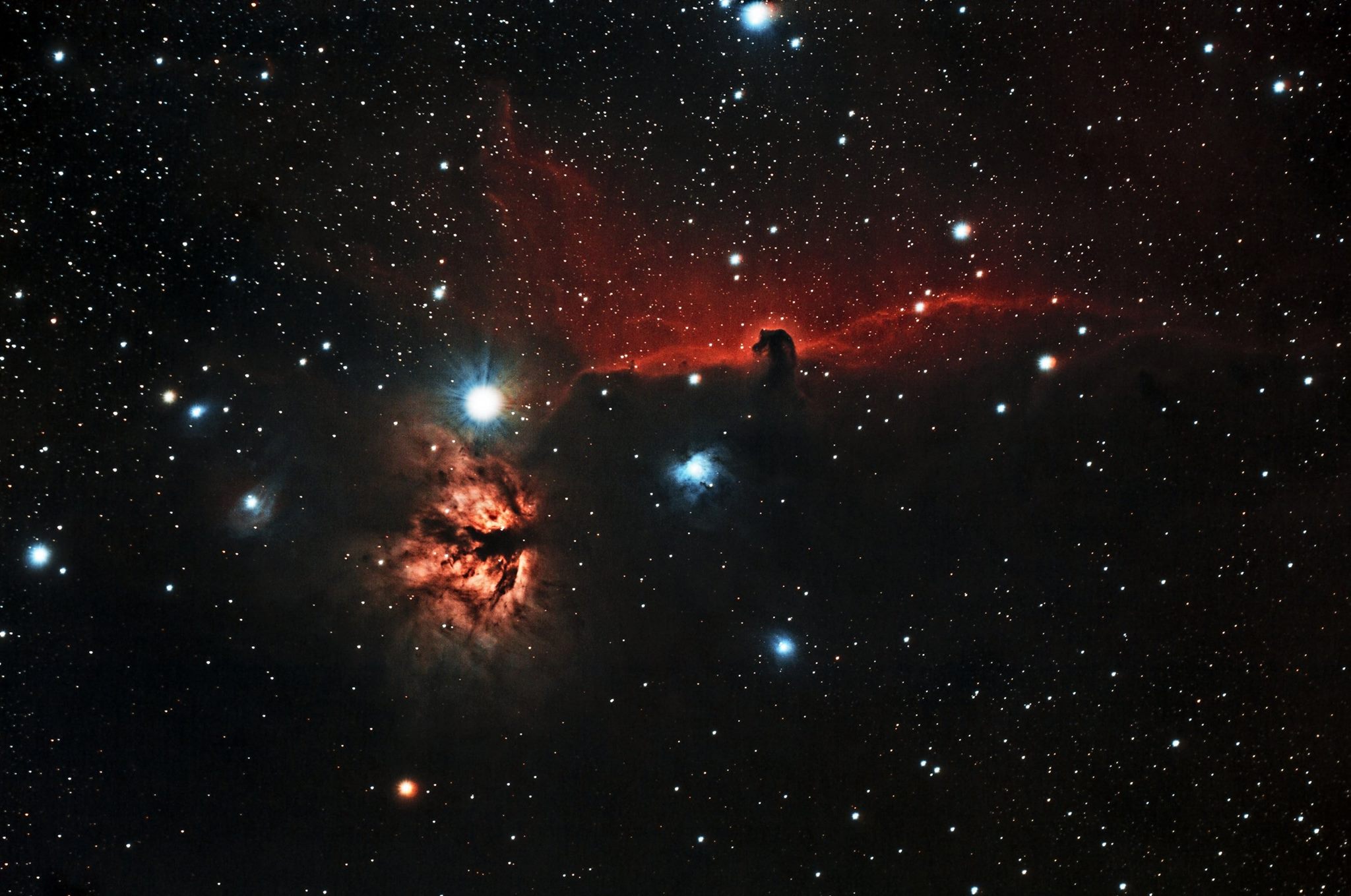
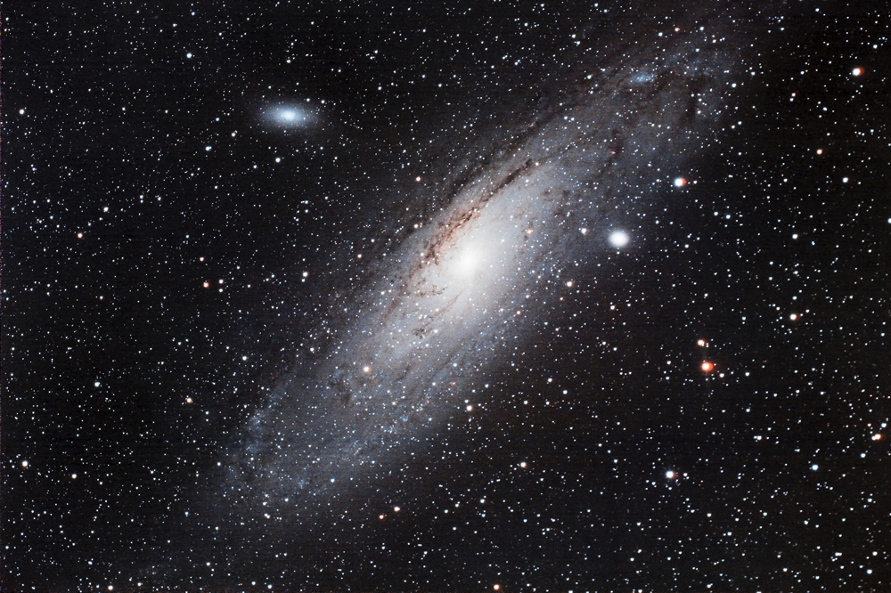
Before we get started, I wanted to share a couple of photos my co-worker John made. He took the pictures using an 81mm refractor telescope made by William Optics, paired with a Canon T5 DSLR camera (plus a couple of laptops). He used PHD2 software to guide the telescope, and Backyard EOS for the image capture. For each picture, he took 24 individual exposures (of 5 to 7 minutes each), and combined and enhanced them with PixInsight and Photoshop software. These two photos are of the Horsehead and Flame Nebulas, and M31 Andromeda Galaxy. Pretty amazing, eh!?!
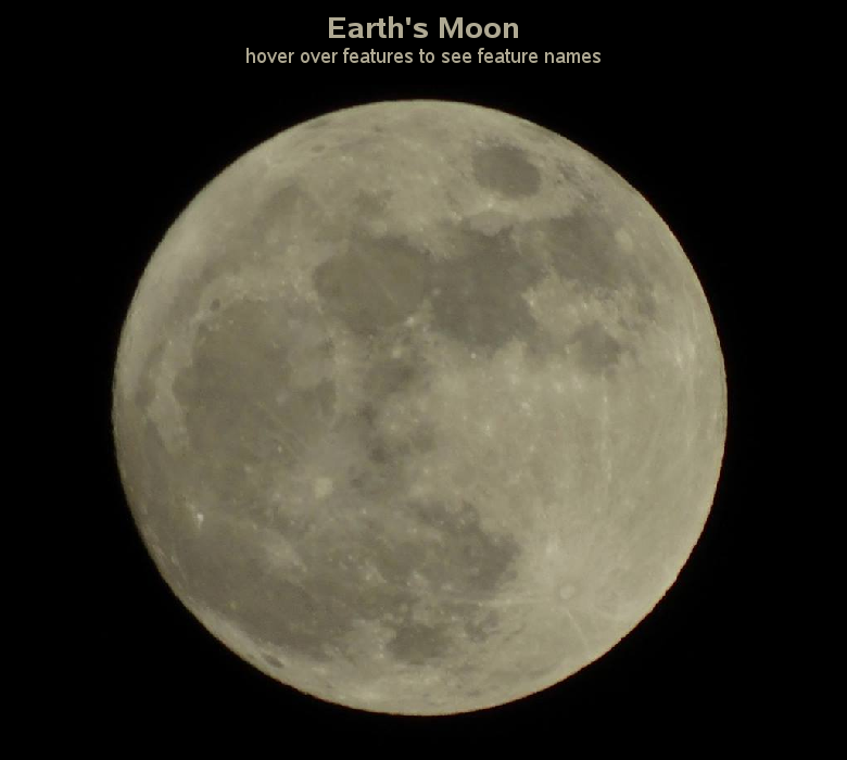
Now, let's focus on the moon map! A while back, I used my Sony camera on a hand-held monopod and captured a somewhat decent picture of the moon (nothing like my friend John's works of art, but it did let me see more detail than I could with the naked eye). It was then that I realized I didn't know the names of any of the features.
So I did some research, and found various maps and labeled images to help me identify the features that were prominent in my moon photo. I then came up with a coordinate system for my moon photo, and used SAS/Graph Proc Gmap to create a blank rectangular map with the moon image annotated on to it, and this allowed me to annotate html hotspots with hover-text and drilldowns at the desired coordinates.
Click the moon image below to see my interactive map. Try hovering over the prominent features (craters & seas) to see their name, and click on them to launch a Google search. Can you find the crater Tycho? How about the Sea of Tranquility? ... And if you're really good, how about the location of the first moon landing?
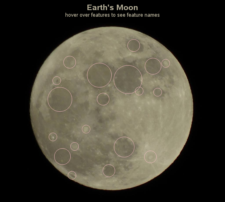
Knowing which features I did & didn't create hotspots for might be a little difficult, so I created a 2nd version where I made the hotspots visible. I call this my 'cheater' version. Now see if you can find the moon landing location.
Hopefully you've learned a little about the moon, and also a new SAS capability you didn't know about before. What else could you do, annotating hotspots on an image?


3 Comments
The horsehead and M31 pictures are some of the best I have seen from an amateur with any size or type of scope. To think that was done with what amounts to a 3" refractor is kind of mind boggling. Well done to your friend, and I enjoyed the moon map as well.
Fantastic photos.Thank you for sharing.
I've always wanted to do this - that, and use some Mars Rover images to annotate onto Mars... hmm, an animated gif of little rovers and their paths... very cool and inspirational!!!