“Good afternoon, Mr. Yakamoto. How did you like that three-pack of tank tops you bought last time you were in?”
Washington D.C. Year 2054. Chief of PreCrime John Anderton is running from the law for a crime he has not committed yet. After a risky eye transplant in order to avoid the city-wide optical recognition system, he enters into a mall where his borrowed identity is immediately recognized and commercial adds and offers pop up on digital billboards based on his personal taste and past purchases.
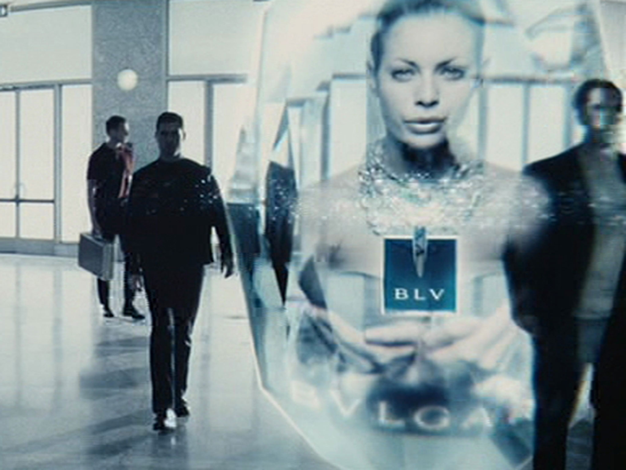 The reality is that we don’t have to wait until 2054 for this legendary scene from the 2002 movie Minority Report to happen. This is already here. Now.
Fortunately, we don’t register people with optical recognition (yet!), but we can already track and identify individuals’ position using the mobile phones we all carry -- and from that information make personalized offers.
The technology is already here.
- All mobile phones now have a built-in global positioning system (GPS) and can communicate geographic positions to some remote system, as well as some unique identification information — anonymously or not.
- Dedicated apps are using beacon technologies like Apple’s iBeacon to detect user proximity to a certain area and improve in-shop experiences.
- Wi-Fi based radio frequency identification (RFID) technology allows passive identification and position detection of devices in large areas and can track movements and other behavior characteristics.
These are just a few examples of the many technologies available today.
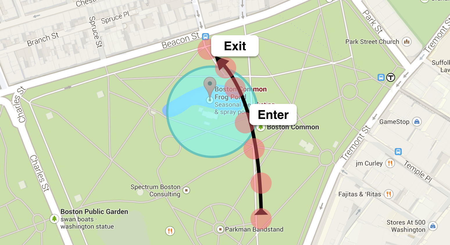
One of the most important underlying concepts behind all location-based applications is called geo-fencing. Geo-fencing is a feature of an application that defines geographical boundaries. A geofence is a virtual barrier. So when a device enters (or exits) the defined boundaries an action is immediately triggered based on specific business needs.
 Even though advertising and marketing are the most direct and well established application of geo-fencing, this is just the tip of the iceberg. Technology advances have created GPS chips so small that they can be put on any sized object or wearable. And the Internet of Things, with the constant interconnection of all type of devices to cloud-based applications, will tremendously expand the use of location-based applications.
One of the early commercial uses of geo-fencing was in the livestock industry, wherein a handful of cattle in a herd would be equipped with GPS units and if the herd moved outside of geographic boundaries set by the rancher, the rancher would receive an alert.
What applies to the flow of cattle can also be applied to:
- Fleet management: When a truck driver breaks from his route, the dispatcher can be alerted and act immediately.
- Customs transport: Authorities can track vessels' positions and detect when a ship is not in the area it should be or forecast and optimize harbor’s arrivals.
- Public areas, like airports or train stations: The flow and density of people can be detected in real time in order to remove bottlenecks and optimize queuing times, adapt path guidance, organize staffing or optimize flow path and procedures.
- Galleries and museums: Allows administrators to quantify the popularity of exhibits, identify under-used spaces, and use visitor behavior to optimize future events.
- Shopping centers: Shows in real time how many people pass in front of a certain store, shelf, information point or door, and where these people are coming from. How many people are watching a certain TV ad on a billboard? Where is the best place to position a promotion based on foot traffic? Hence allowing optimizing store workflow (goods supply, cart management…) and layout.
And there are countless examples from manufacturing, industry, security or even households -- like an ankle bracelet alerting authorities if an individual under house arrest leaves the premises, or automatically switching lights off when the whole family left the house.
An important paradigm that is inherent to all those applications is the immediacy of action.
In order to react appropriately, the position information has to be processed immediately, with low latency, whatever the volume of events it is required to analyze. Taking too much time to react is not an option in such cases as the subject/device will already have moved to another location, hence a delayed reaction is obsolete.
Of course, a timely reaction is just one part of the game. We also need to react appropriately. Deciding the best action to apply often means being able to detect specific complex events patterns out of the masses of events and to apply high end analytics or machine learning algorithms on real-time data streams. And this is where SAS Software like SAS® Event Stream Processing comes into play, providing high performance and low latency geo-fencing analysis, high end streaming analytics as well as real-time predictive and optimization operations.
As Minority Report's John Anderton finally reveals, once people are aware of their future, they are able to change it.
So leave the Precogs in peace and learn more about SAS® Event Stream Processing and the SAS solutions for the Internet of Things on the SAS and the Internet of Things page.